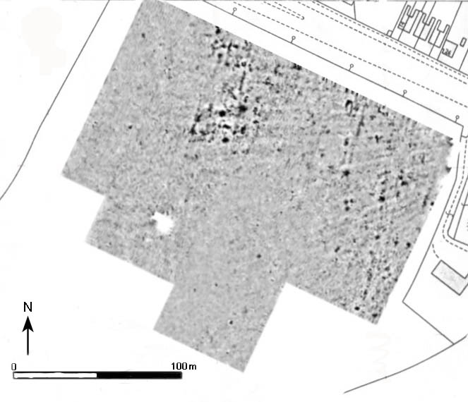
Geophysical Survey
Magnetometer survey is often the most effective
and economic way of detecting buried archaeology in the field.
Souterrain use a Geoscan Research Fluxgate Gradiometer with digital
encoder. The data is collected in a mesh of grids that have been
accurately set out using a GPS. Data is then produced graphically
and plotted to base-mapping.
The consistency of the GPS useage throughout the process of geophical
survey data collection and subsequent siting of exploratory trenches,
ensures close targetting of suspected archaeological features.