Earthwork
surveys
The
first stage of archaeological investigation on many non-arable rural
sites is often topographical survey, especially where earthworks
are visible or suspected.
Sometimes
earthworks are in low relief or partially hidden by high grass and
other vegetation. These may be difficult to discern with the naked
eye.
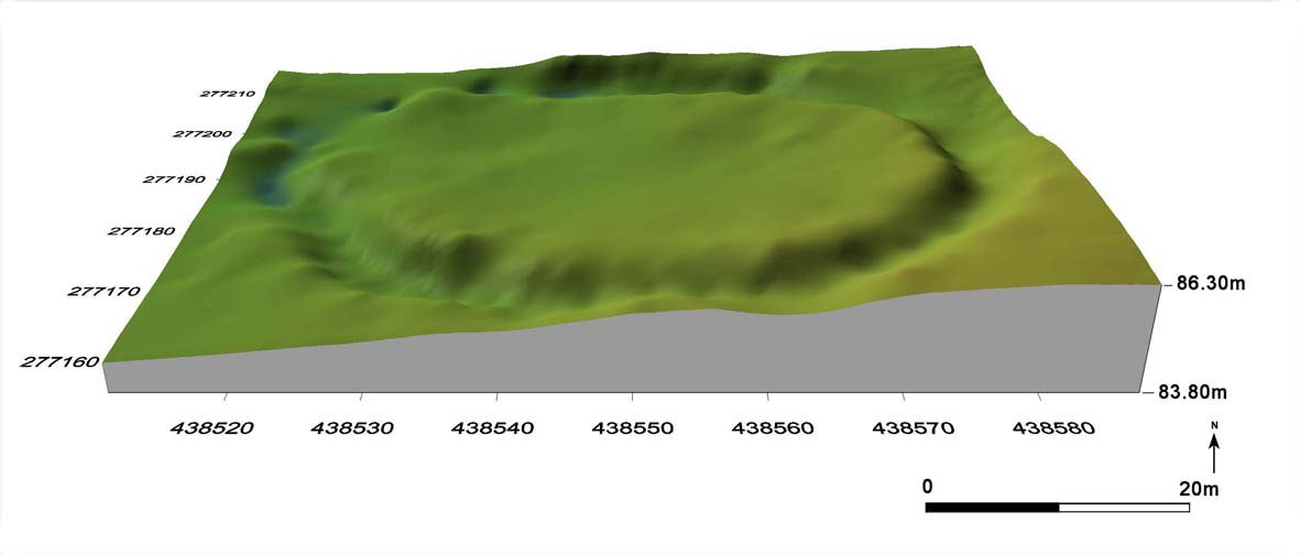
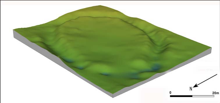
The
GPS technique utilises a rapid automated sampling procedure along
regularly-spaced transects. In this manner, subtle changes in the
landscape may be recorded. The results may be produced graphically
as contour image or 3D Digital
Terrain Model (DTM), an increasingly
popular tool to assist in archaeological site analysis.
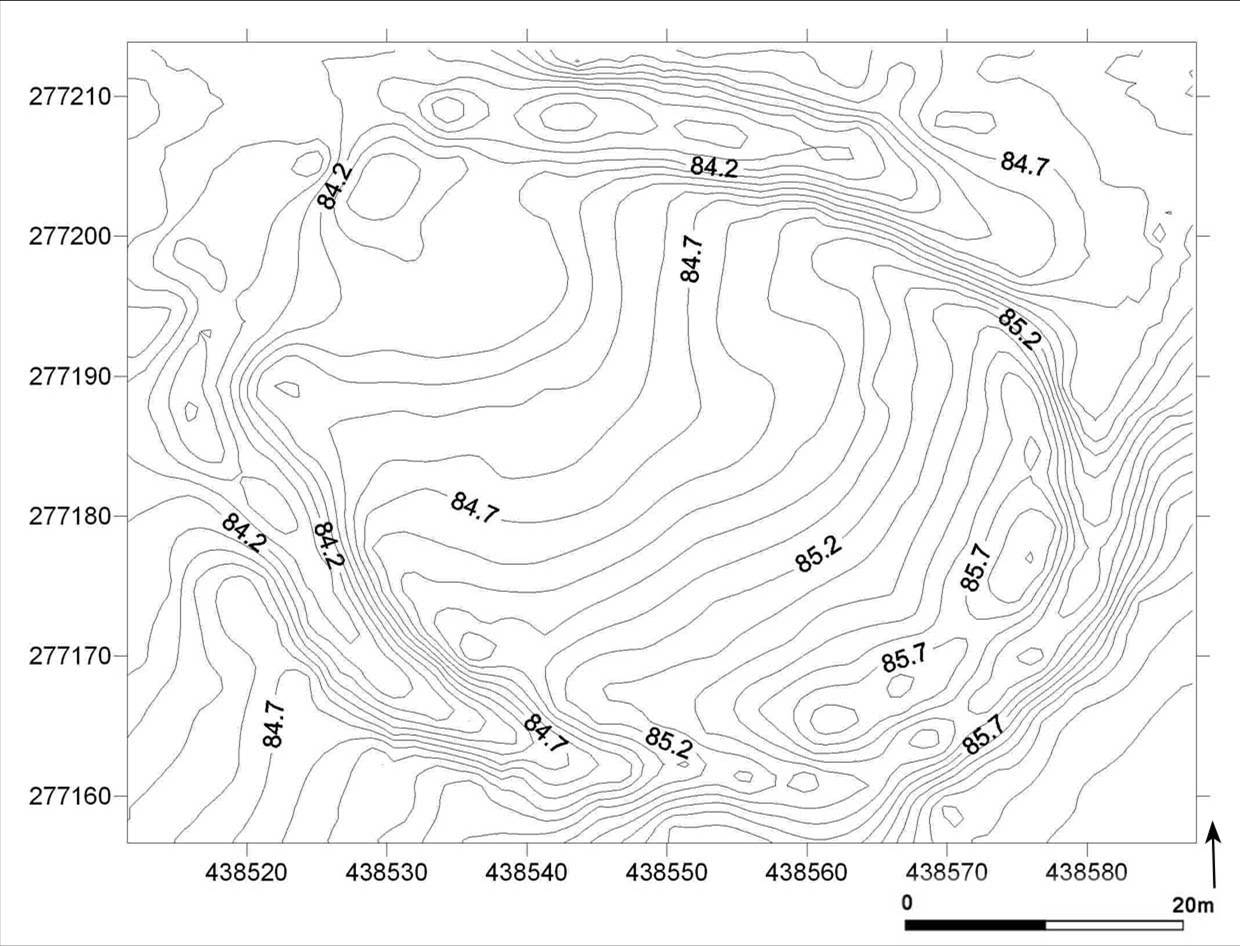
Contour survey of prehistoric earthwork at
Piles Coppice, Warwickshire