Souterrain
|
t:+44 (0)1234 712801 m:+44 (0)7952 057676 e:gps@souterrain.biz |
||
| HOME | |||
|
||||
| ©2014
Souterrain Archaeological Services Ltd
All rights reserved | ||||
Souterrain
Archaeological Services
Surveying the Historic Environment
t:+44 (0)1234 712801 m:+44 (0)7952 057676 e:gps@souterrain.biz
HOME
Geographical Information Systems are increasingly employed in archaeology as a research tool to sort and analyse the growing body of data, which is mostly a direct result of archaeological planning considerations.Simply put, GIS is a system of hardware, software and procedures to manipulate, analyse, model and represent data referenced geographically.
It is based on multiple layers each representing different types of landscape information, e.g. topography, hydrography, road networks. Each layer is linked to tabulated data.
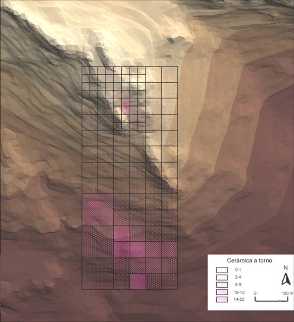
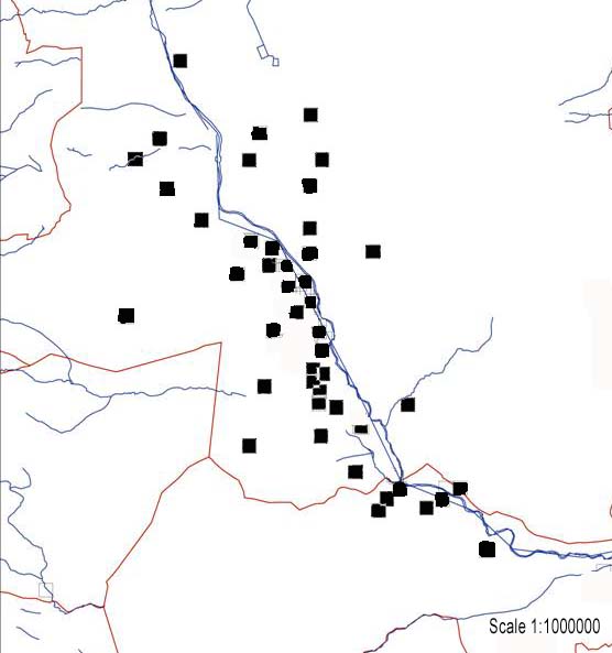
There are many applications of a GIS in archaeology:
Data inventories
Spatial analysis
Distribution maps
Buffer zones or distance areas
Line of sight: viewshed maps
Predictive modelling
©2014 Souterrain Archaeological Services Ltd All rights reserved
Registered in England and Wales No. 03394485